Blueberry3D Terrain Editor is the Blueberry3D standalone content creation tool to build real-time 3D databases.
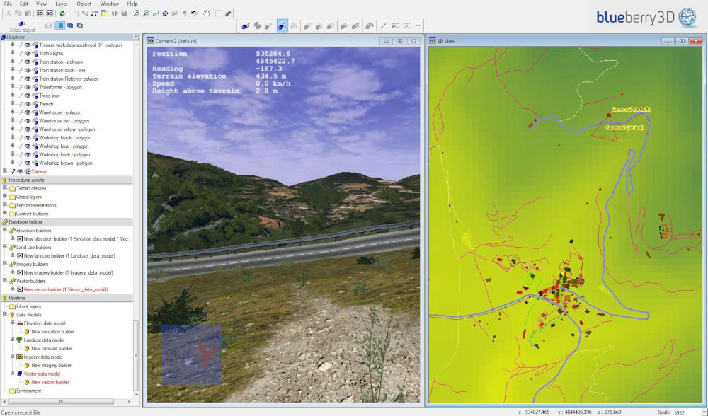
Blueberry3D® Terrain Editor is a complete, visual and interactive environment with a logical and intuitive workflow to fully design in no time a new visual database directly from geographical raw data (DTED/DFAD elevation data, GIS vector data, Imagery) and existing 3D models (or terrain) in OpenFlight format.
Through several parameters the end-user will define and set the procedures that will generate the 3D content from the geographical raw data. Those procedures will then refine the geographical data resolution by adding 3D details and textures thanks to fractal and procedural oversampling.
Blueberry3D enhances raw data resolution thanks to real-time procedural approach. It generates very precise and realistic terrain grounds for vehicle-driving simulation and soldiers training
Through very performant load-balancing mechanisms Blueberry3D can handle either low and high altitude flights over extremely realistic and large 3D scenes. It makes it the perfect technology to deal with helicopter or UAV simulation systems
Want to get a complete description of the Blueberry3D features and suite of software? Fill in the form and we will send you the Blueberry3D brochure.
Contact a Blueberry3D expert
Need more information about Blueberry3D? Do not hesitate to contact us. A Blueberry3D expert will get back to you by telephon or email to answer your questions.
This website uses cookies to improve your experience while you navigate through the website. Out of these, the cookies that are categorized as necessary are stored on your browser as they are essential for the working of basic functionalities of the website. We also use third-party cookies that help us analyze and understand how you use this website. These cookies will be stored in your browser only with your consent. You also have the option to opt-out of these cookies. But opting out of some of these cookies may affect your browsing experience.
Necessary cookies are absolutely essential for the website to function properly. This category only includes cookies that ensures basic functionalities and security features of the website. These cookies do not store any personal information.
Any cookies that may not be particularly necessary for the website to function and is used specifically to collect user personal data via analytics, ads, other embedded contents are termed as non-necessary cookies. It is mandatory to procure user consent prior to running these cookies on your website.